
Guides · updated 14 August 2026
How do satellites detect wildfires?
A fire emits infrared radiation very different from its surroundings. From orbit, specialized sensors spot these “thermal anomalies”, the backbone of every real-time fire map, kanari included.
As of 28 September 2026, kanari has archived 38,932 significant satellite-detected fires worldwide since August 3, 2026, including 280 in France. Source: kanari.io, open data (CC BY 4.0).
Two complementary satellite families
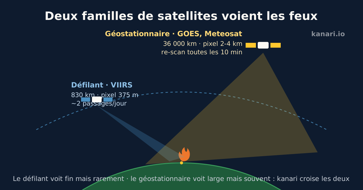
Polar-orbiting satellites (VIIRS on NOAA-20/21, historically MODIS) circle the Earth at 830 km and see every point of the globe about twice a day per satellite, with remarkable detail: a VIIRS pixel is 375 metres, enough to spot an established fire of a few hundred square metres.
Geostationary satellites (GOES over the Americas, Meteosat MTG over Europe and Africa) stay fixed 36,000 km above the same point and rescan their zone every 10 minutes. Less precise (2 to 4 km pixels), they excel at catching fast-growing fires early.
From hot pixel to alert
Algorithms compare each pixel to its neighbours and its history: a point abnormally hot in mid-infrared, at night or by contrast with its surroundings, becomes an “active detection”. Each detection carries a position, a radiative power (in megawatts) and a confidence level.
kanari aggregates these detections (NASA FIRMS, GOES read directly from the raw feed, Meteosat MTG), clusters them into fire events, cross-checks them with AI-verified witness reports, and displays them within minutes. The satellite-plus-human cross-check is key: the satellite confirms the witness, the witness sometimes beats the satellite.
What satellites cannot see
A very small or nascent fire can slip between two polar satellite passes (up to 12 hours apart at mid-latitudes). Thick clouds, dense smoke or canopy can mask the signal. A hot pixel is not always a wildfire: industrial flares, agricultural burns and even overheated metal roofs generate false positives, which algorithms partially filter.
That is why human reports matter: on kanari, a geolocated witness report can surface an ignition before the first satellite detection.
Frequently asked questions
How fast can a satellite detect a wildfire?
Geostationary satellites (GOES, Meteosat MTG) rescan their zone every 10 minutes with 2 to 4 km pixels. Polar-orbiting satellites (VIIRS, 375 m resolution) pass about twice a day per satellite. kanari displays published detections within minutes.
How small a fire can a satellite spot?
A 375-metre VIIRS pixel can reveal an established fire of a few hundred square metres. A very small or nascent fire can slip between two passes, or be masked by clouds, dense smoke or canopy.
Can satellite detections be false positives?
Yes: industrial flares, agricultural burns or overheated metal roofs generate hot pixels without any wildfire. Algorithms filter part of them, and kanari cross-checks detections with AI-verified human reports to consolidate confidence.
See the live situation: world wildfire map · water bombers live · live statistics
Also worth reading
What to do during a wildfire: the reflexes that save livesHow does a Canadair water bomber work?Fire weather: understanding wildfire riskSmelling smoke outside: how to check if there is a fire near you
kanari is an independent, free information service, not an official alert channel. In an emergency call 112 (EU), 911 (North America) or your local emergency number.